How does someone prepare for a visit to The Grand Canyon? It’s only one of the most remarkable sights our human eyes can see. Larger than the state of Rhode Island, it’s almost too extraordinary for us to comprehend.
Physically, it may not be too hard to prepare.
Mentally, it may be impossible to fully prepare.
If you’re like me, you’ve heard many anecdotes about someone’s first time seeing The Grand Canyon. You fight the urge to roll your eyes when hearing the same phrases repeated: “incredible”, “inspirational”, “jaw-dropping”.
It’s easy to think that way… until you visit.
I was fully prepared to be mildly amused by The Grand Canyon. I had seen pictures, I knew what people said, I knew what to expect. Or so I thought…
Our Adventure
After spending the previous day in Sedona and Flagstaff, we were ecstatic about what The Grand Canyon had to offer. Our plan was to drive up from our Airbnb first thing in the morning. With a 1.5 hour drive ahead, we loaded up on coffee and muffins from Firecreek Coffee, and set sail!
The drive from Flagstaff was beautiful. We went through Coconino National Forest as it was covered in snow. Just the drive itself was a blast when you’re not used to the terrain.

Once arriving at the canyon, we entered the South Entrance and purchased a National Parks Annual Pass, per the recommendation from a friend.
TIP: We cannot recommend purchasing this pass enough. If you plan on spending multiple days at a park or visiting more than one park in a year, this is totally worth it! Plus, it has saved us money visiting National Monuments as well.
After entering the park, we didn’t know what to do or where to go. We followed signs until we got to the visitor center outside of Mather Point. This is essentially the first stopping point if you come in through the south entrance.
We parked and walked to the (closed) visitor center. There were maps sitting out and packets with helpful information.
Quickly, we discovered that Mather Point was just around the corner, so we hurried over for our first viewing.
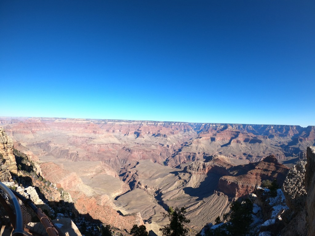
Imagine the repeated phrases we mentioned at the start of this article. Now think of more and include unexpected overwhelming emotions. Even that is not enough to emphasize the magnificence of The Grand Canyon and feelings I experienced in that first viewing.
Our Journey
We finished at Mather Point around 10AM. This gave us time to drive into Grand Canyon Village, only about a mile down from where we were.
Stopping at the Grand Canyon Village Market & Deli, we went in to purchase souvenirs and speak to a ranger about potential hikes.
Coming into the trip, our research told us that Bright Angel Trail is the most popular hike at the park. We were ready to take it on but after speaking with a ranger, he advised that the trail was too icy for hiking. How many people are aware that The Grand Canyon sits at over 6,500 feet above sea level???
Thankfully, he suggested another trail that has similar characteristics and is popular for views: The South Kaibab to Ooh Ahh Point Trail.
With our map in hand, we drove towards the trailhead. During our short drive, we saw a string of cars pulled off to the side of the road. Curious, we pulled over and finally saw the spectacle: elk!
There were half a dozen elk walking casually along the side of the road.
TIP: The ranger also noted that there is no parking at the South Kaibab Trailhead. You can only take a shuttle. He marked on the map where you can park along the road, which adds roughly half a mile to your overall hiking distance.
Not wanting to rely on a shuttle, we parked along the road and grabbed our backpacks. The walk to the trailhead was easy and we passed more elk on the way!
Originally conscientious of time, we were going to hike around 3.5 miles roundtrip.
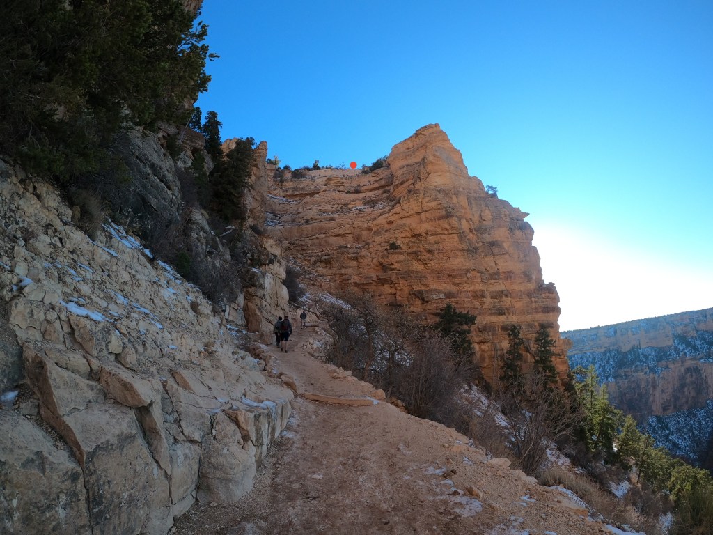
The beginning of the trail was covered in ice and only switchbacks. There was nothing to hold on to, so we took our time and were thankful we had hiking shoes. A lot of people were struggling to walk down the ice, us included.
Once we finally made it into the sun, the ice melted and the temperature was starting to rise as we descended into the canyon.
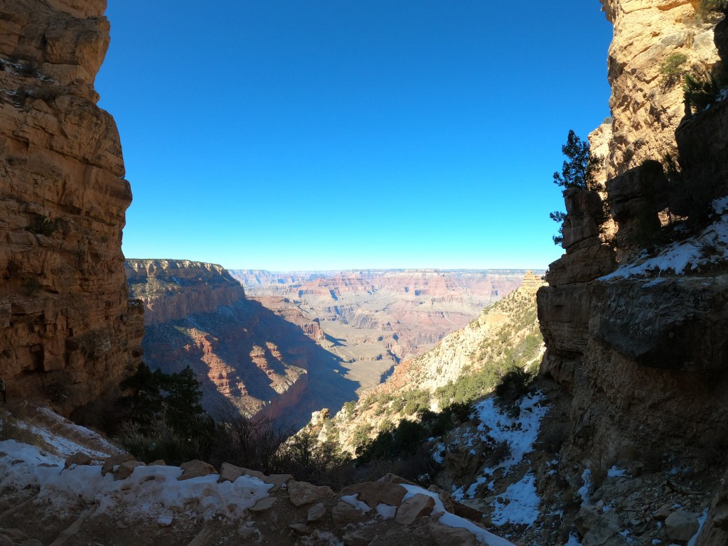
Arriving at Ooh Ahh Point, we were excited to rest and take in the views.


We made it to our goal before 1PM. As much as we enjoyed the overlook, we didn’t feel completely satisfied and wanted to see more.
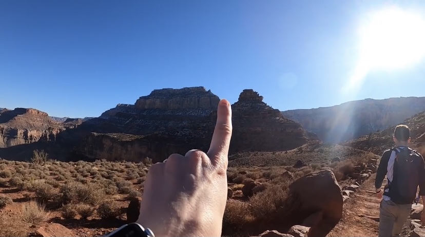
Continuing our gaze over the natural beauty, we saw people far below us in the canyon. I tried to follow their trail and realized it followed the one we were on.
We asked a nice couple as they walked by and they said it was the trail to Skeleton Point. A 12.6 mile trail roundtrip.
We both felt that if we turned down the opportunity to go deeper into the freakin’ Grand Canyon, we would be kicking ourselves later.
Deciding to take on the additional 9 miles, we continued decreasing in elevation and rising in temperature. It was in the low 40s at the start of the trail. We were now in the mid 60s and taking off layers in an attempt to counter our sweat.
The hike down was thrilling and one of the most memorable moments in both of our lives. We had the trail almost solely to ourselves, minus a couple of guys about a quarter of a mile down the trail. We reached Cedar Ridge, which was the only other marked stop on the map before reaching Skeleton Point.
At Cedar Ridge, we encountered a crew performing maintenance on the trail. We could tell they had been out there for hours and the work looked tiring. Unbothered by carrying large buckets of stones, they were singing the Shrek soundtrack and cracking jokes as we walked by. I guess working with a view like The Grand Canyon makes any labor fun?
TIP: If needed, there is a privy at Cedar Ridge. I have never encountered an enjoyable privy, but this one was definitely top of the line as far as privys go.
Also during the hike, we encountered another “crew”. This time it was donkeys. No, seriously.
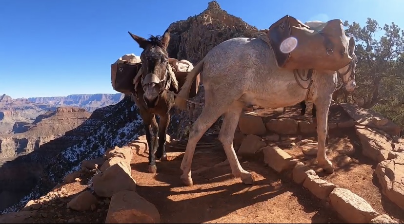
Apparently mule excursions are a popular attraction at the park, which looked like a blast! When we go back, we are definitely going on a mule tour.
Noticing the time and realizing we weren’t even halfway yet, we tried calculating if we could make it down and back before sunset (this was during winter, so it was getting dark early).
We were hesitant, but since we still had 2 people only slightly ahead of us, we pressed on.
The rest of the trail was well maintained and easy to follow. The slope was not as steep once past Cedar Ridge, but still a descent.
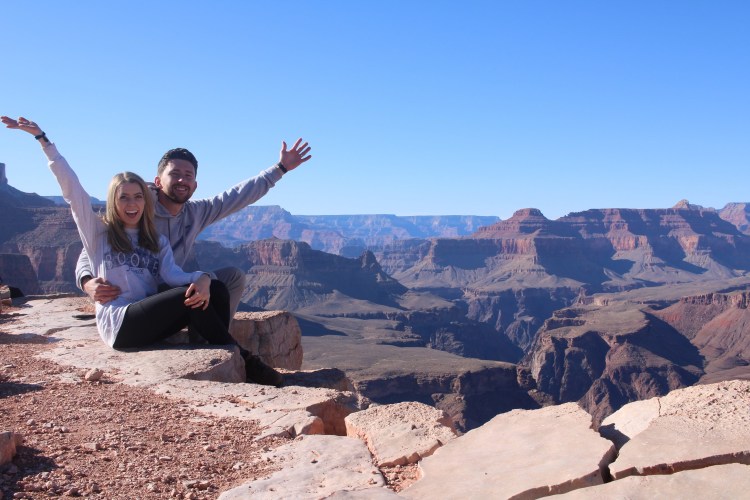
The feeling of accomplishment upon reaching Skeleton Point was intoxicating. We felt like we were on a different planet. Never did we think something like this was on earth, let alone the United States.
TIP: If you do hike this, go a little beyond the Skeleton Point sign. You will be able to see the Colorado River!
After more photos, more deep breaths, and a few snacks. We began our climb back to where we started.
In order to make sunset at a different overlook, we ran up the trail. I wish I was joking.
The previously mentioned workers were packing up as we made it back to Cedar Ridge. This helped us realize we had enough time and could slow our pace.
Now at the bottom of the switchbacks, we see that they were still covered in ice. Fortunately, it was not as slippery when going up.
After completing the final climb, we were again at the canyon rim and walked to our car. Our adrenaline was at full speed. Only when we finally slowed down did we realize we ended up hiking over 13 miles.
TIP: This hike was not easy. It’s correctly rated as “hard” on AllTrails. There were multiple signs along the trail with heat exhaustion warnings. We started with 3L of water and had no issues since we were there in winter, but we see how difficult this would be in the summer. Be smart and know your limits.
Our Evening
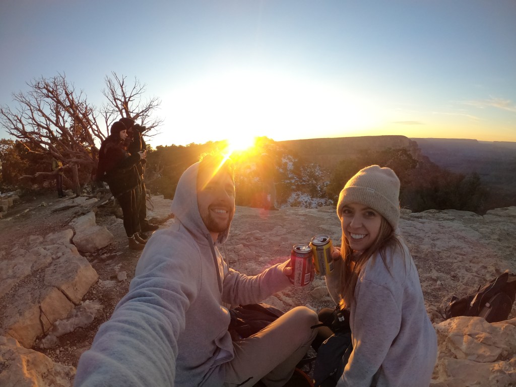
Thanks to our wonderful physiques (+25 breaks), we were able to make it back early and pick up dinner at the cafeteria in the Grand Canyon Village Market & Deli (get the black bean burger!!). While there, we asked a ranger about the best sunset spot and he suggested Yavapai Point.
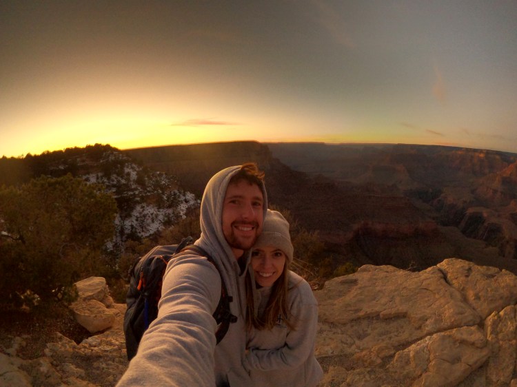
Watching the sun fall beyond the Canyon looked like a painting. It’s truly something magical that cannot be created by man.
Concluding the best sunset of our lives, we made our way out of the park and off to our next Airbnb.
We hope this recap helps you navigate your trip with ease. Even if we could have done the Bright Angel Trail instead, we would have kept our day the same.
Go into the park with an open mind. Listen to what creation has to tell you.
Cheers!

3 thoughts on “A Grand Journey at The Grand Canyon”